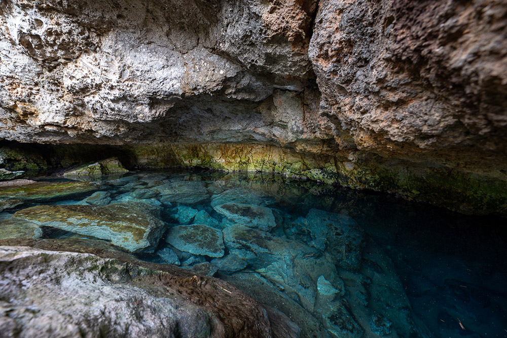
Giardini d'acqua Porto Cesareo
“If you throw something in the sea, (after an unspecified and unknowable amount of time) the sea will give it back to you: wrought, finished, polished, shiny or opaque, depending on the material, and also wet, making the colors are even more vivid.”.
B. Munari (philosopher and artist, 1907-1998)
The spunnulate
On windy days, when the land and the sky change form and the clamor of the waves punctuates the silence, the sea takes up its ancient work of carving lace into the coastline. Meanwhile, hidden away, it sneaks into the stone from below and slowly, patiently carves out caves and cuts into the rock, like a scribe recording their holy testament. While, in scientific terms, the spunnulate are are sinkholes of karstic origin, created through the chemical and mechanical action of the sea water, for our senses they represent a work of art in constant transformation.
Karst Systems
Karst systems constitute one of the principal agents of landscape formation, both on the surface and underground, where it can pose serious risks for the stability of such terrain. The fragility of naturally occurring karstic caves, exacerbated by disrepair and/or alterations due to human activity, meant that there is the distinct possibility of a surface rupture. When this happens at ground level, we see the formation of sinkholes, with direct consequences for infrastructure, the built environment, and communication networks.
The coastal road from Taranto to Porto Cesareo, heavily traveled in the summer months, runs across the location of several spunnulate. In 2010, a section of road that connects Torre Lapillo to Torre Colimena running above one such sinkhole had to be shut to traffic and rerouted, as the asphalt was at risk of giving way below the weight of the vehicles in transit. The project for ensuring safety in these locations, which was conducted and completed in 2018, included the construction of a bell-shaped bridge at road level that travels above the sinkhole, relying on weight-bearing pylons at both ends. Tourist activity in and around Torre Castiglione has brought about the construction of many homes in close proximity to the coastline: in many cases, the associated structures, garden walls and private roads are on the verge of collapse, or in proximity to areas that are.
Detail sheets
Evolution of Karstic Systems

Causes for Collapse
- Low mechanical resistance of the particular rocky masses (i.e. “soft rocks” from AYDAN et al., 2005)
- Physio-mechanical degradation of the rocky mass caused by the absorption of water molecules
- Weight-bearing loads created by structures on the surface
- Vibrations due to vehicular traffic
- Introduction of liquids underground, such as water and sewer pipe leakage due to illegal underground drainage.
Evolutionary model for collapse in coastal areas

Thanks to the coalescence (fusion) of multiple sinkholes (Fig. 4a-b) extended depressions up to a thousand square meters can be formed (Delle Rose & Parise, 2004); these are separated from the sea by diaphragms of unstable and intensely karstic calcareous rock (Fig. 4c), whose collapse (Fig. 4d) can provoke the formation of proper coastal canals (Fig. 5). The phenomena of coastal sinkhole fusion, occurring together with systems of transverse fracturing, can cause the formation of coastal inlets (Delle Rose & Federico, 2002).
Tsunami Territory
Over the past twenty years, the occurrence of devastating tsunamis around the globe has raised awareness of the need to measure coastal regions subject to this phenomenon, particularly in the Mediterranean basin. Some of these studies have been concentrated in southern Puglia, the coastal area that is most exposed to tsunamis in this region, thanks to numerous seismic structures capable of bringing about this phenomenon that coexist with surrounding bodies of water.
Detail sheet
Sea Quake Chronology
Historically speaking, there are two principal tsunami events involving the Ionian coastline of the Salento peninsula responsible for the accumulation of massive sea boulders deposited on land:
5 December 1456
Among the most catastrophic in local history, this event affected all of southern Italy, from Lazio all the way to Basilicata, from the Tyrrhenian to the Adriatic, causing the death of tens of thousands of people. The tsunami was not generated directly by an earthquake; rather likely it was a large underwater landslide, triggered by intense seismic jolting along the steep escarpment that is located just off the Salentine-Ionian coastline (see interview on 18 Oct. 2012 with Unisalento professor Paolo Sansò ).
25 April 1836
This tsunami was generated by a powerful earthquake, whose epicenter was located in the coastal area of Rossano Calabro, just 120km south-west of the Ionian coast in Puglia.
In both cases historical documentation is lacking, since the coastal areas at those times were practically uninhabited. The only evidence of these events is the accumulation of rocky masses on land that were found and analyzed. Some useful archaeological data could still be provided by studying the potential damage done to the numerous coastal watchtowers built along the coast in the second half of the 16th century, which were abandoned by the 19th century (from Le creste sabbiose sulle piattaforme costiere rocciose come indicatori dell’impatto dello tsunami: un’analisi multidisciplinare lungo la costa ionica della Puglia meridionale, Geoscienze, 2020).

The boulders of Torre Castiglione
Geomorphic research conducted along Mediterranean coastlines revealed the effects of tsunamis across the centuries: they appear in the form of boulders, rocky masses of large dimensions, at times isolated, stacked, or in large piles, which were broken off by the water and carried dozens of meters inland.
Since the storm surge in the Ionian and Adriatic seas are not sufficient to power the carving up and transport of such large masses, their accumulation in these areas is suggestive, instead, of the impact of a tsunami that would have hit the southern coastal region of Puglia in the past five centuries, presumably involving the area of Torre Castiglione as well.


